
Ready to Coordinate Drone Operations at Scale?
Speak with Dronecloud about scalable airspace management, operational coordination, and BVLOS-ready operational infrastructure.
AIRSPACE MANAGEMENT

01
Gain a single, real-time picture of the airspace. Integrate live data, operational intent and environmental factors to make smarter, faster decisions.
Map Layers

Weather Advisory
Moderate Winds
02
Our layered architecture models the complexities of the airspace to deliver clarity, context and confidence for every operation.
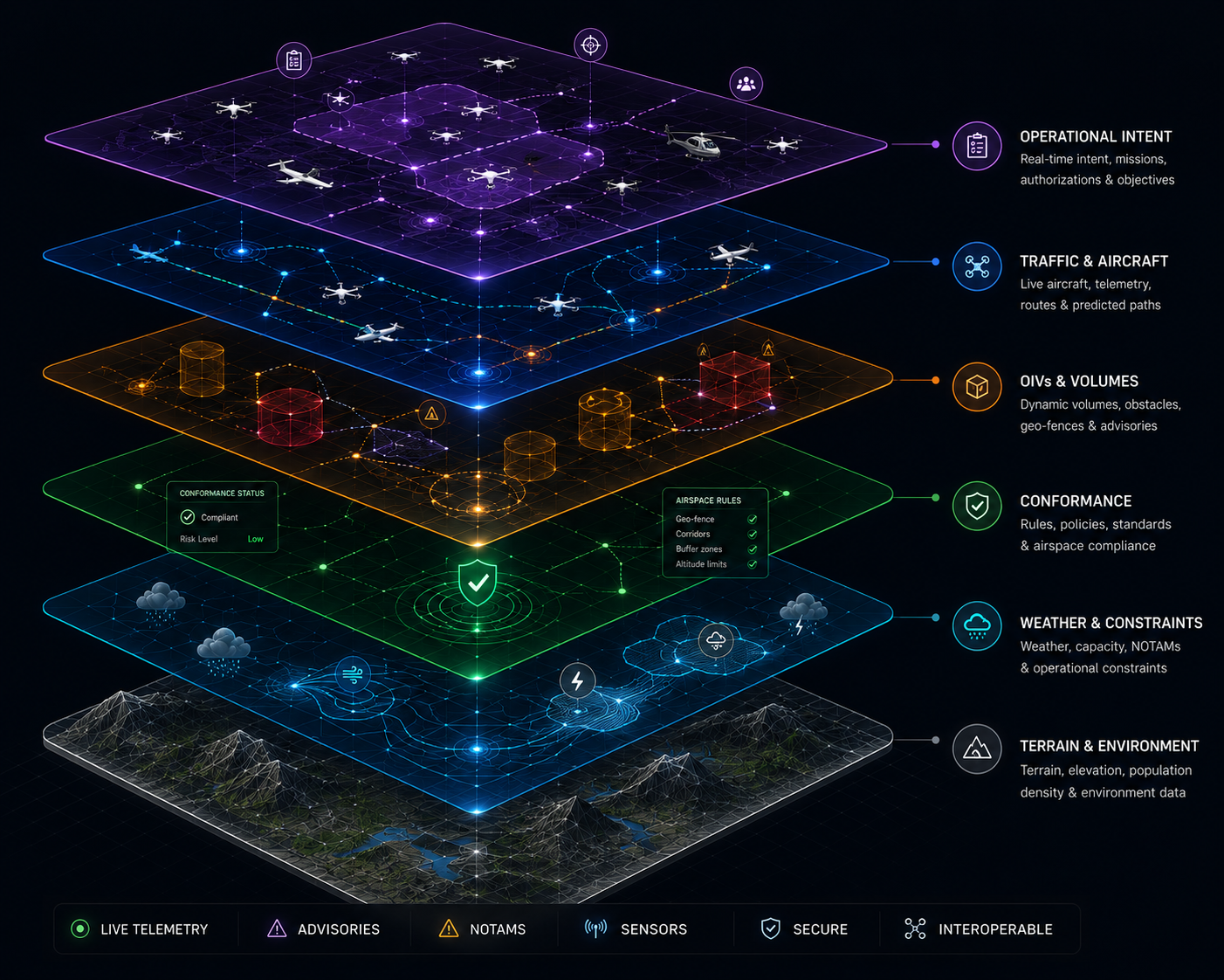
Operational Intent
Mission plans, routes and objectives
Traffic & Aircraft
Live telemetry and traffic information
OIVs & Volumes
Corridors, operational volumes and geofences
Conformance
Rules, policies and compliance monitoring
Weather & Constraints
Weather, NOTAMs and airspace constraints
Terrain & Environment
Terrain, obstacles and environmental data
03
Automatically detect, evaluate and resolve conflicts before they become risks.
Conflict Detected
12:42:11Z
Resolution Applied
Separation Assured

Altitude
1,150ft
Speed
38kts
Vertical
300ft
Horizontal
5.2nm
04
Dronecloud connects the people, systems and organisations that make modern airspace operations possible.
Operators
ANSPs
Emergency
Services
Infrastructure
Owners
Enterprise
OCCs
UTM
Providers
Airspace
Stakeholders
05
Trusted by industry leaders to deliver safe, compliant and scalable drone operations in the world's most challenging environments.
06
Mission-critical visibility and control for operators and OCCs.
Active Missions
24
Aircraft in Air
56
Conformance
98%
Active Alerts
3
View Alerts
Recent Alerts
Conflict Alert
12:42:15Z
Weather Advisory
12:43:02Z
NOTAM Update
12:35:47Z
Weather Overview
Moderate Winds · 15kts
Mission Status
Speak with Dronecloud about scalable airspace management, operational coordination, and BVLOS-ready operational infrastructure.