Customers & partners
Airspace control, simplified
Your airspace & operations. Under control.
Dronecloud is the end-to-end platform for drone operations and airspace management. Built for the organisations that can't afford downtime: Network Rail, National Highways, and the critical infrastructure that keeps the UK moving.


- CNI
- Trusted by Network Rail & National Highways
- 45,229 +
- Flights managed across UK networks
- Multi-site
- Enterprise-scale fleet operations
- CAA
- Aligned with UK regulatory requirements
Our Technology
Built for Critical Drone Operations
Dronecloud combines flight management, airspace awareness, operational approvals, telemetry, and UTM integration to support the next generation of scalable UAS and UAV operations.
Flight Management
Plan and scale complex drone operations
Manage missions, teams, assets, workflows, permissions, risk assessments, and operational evidence from a single platform built for enterprise drone programmes.
UTM
Coordinate airspace with confidence
Integrate operational tools with UTM services to support airspace visibility, operational intent sharing, strategic deconfliction, approvals, notifications, and oversight of drone activity.
BVLOS
Enable beyond visual line of sight operations
Support the transition from local VLOS missions to scalable BVLOS operations with conformance monitoring, telemetry, audit trails, and airspace intelligence.
Compliance by Design
Built-in workflows for permissions, risk assessments, and audit readiness.
Data & Evidence
Capture operational data, telemetry, mission records, reports, and evidence required for safe and accountable drone operations.
Scalable Operations
From small pilot teams to national drone programmes, Dronecloud supports the operating models required for advanced and autonomous UAS operations.
We simplify complex drone operations
Why Dronecloud?
Dronecloud enables organisations to manage large-scale drone activity safely, efficiently, and compliantly. Our platform brings together UTM, flight management, telemetry, airspace awareness, and operational evidence so teams can scale from today’s missions to tomorrow’s autonomous aviation ecosystem. Explore Platform, UTM, Fleet, and Enterprise onboarding.
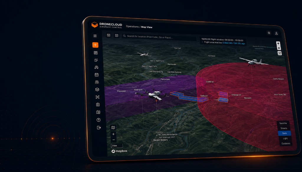
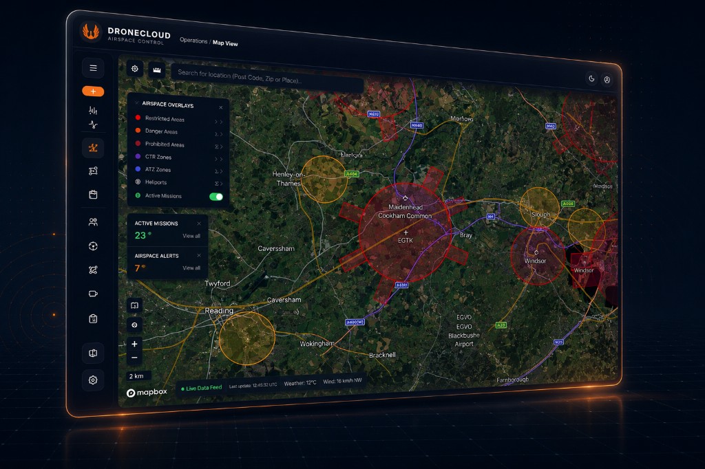
- Live Airspace Visualisation
View missions, airspace constraints, flight volumes, altitude bands, and operational zones in context.
- Strategic Deconfliction & Safety
Identify potential conflicts, coordinate operational intent, support geofence awareness, and reduce risk before and during flight.
- Conformance Monitoring
Monitor telemetry against approved operational volumes and receive alerts when aircraft deviate from planned routes, altitude limits, or mission boundaries.
- Enterprise Flight Management
Manage users, teams, assets, approvals, workflows, mission records, and audit trails across complex drone programmes.
- Critical Infrastructure Ready
Built for organisations operating around energy, utilities, rail, ports, highways, defence, public safety, and other critical national infrastructure.
- API-First Integration
Connect Dronecloud with existing systems, UTM services, telemetry sources, fleet tools, command centres, and operational workflows.
Operations
Flight planning Fleet management
Aircraft
GCS and autopilot
UTM Services
Uncrewed traffic management
Enables complex drone operations at scale
Live programmes
Operational Programmes
Dronecloud participates in flagship UK Future Flight and BVLOS ecosystem programmes — proving operational software in real-world, regulated airspace. View all operational programmes →
Project SOCNI
Achieving a major milestone for the future of UK aviation. Project SOCNI (Scalable BVLOS Operations for Critical National Infrastructure) is the culmination of a collaborative effort between Dronecloud, NATS, Network Rail, Transport for Wales, the British Transport Police and RUAS — an Innovate UK funded programme delivering Beyond Visual Line of Sight.
View programme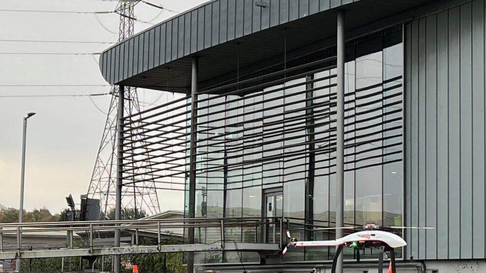
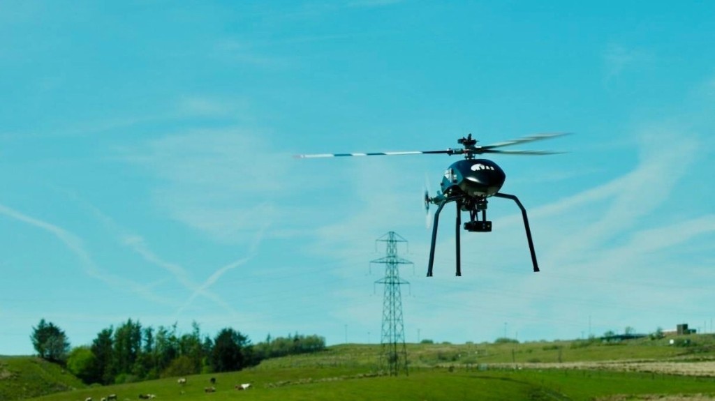
Network Rail BVLOS
Dronecloud and RUAS secure landmark approval for long-range drone flights transforming Network Rail operations. The UK Civil Aviation Authority authorise 70km of BVLOS flights — unlocking safer, smarter and more efficient rail infrastructure management.
View case study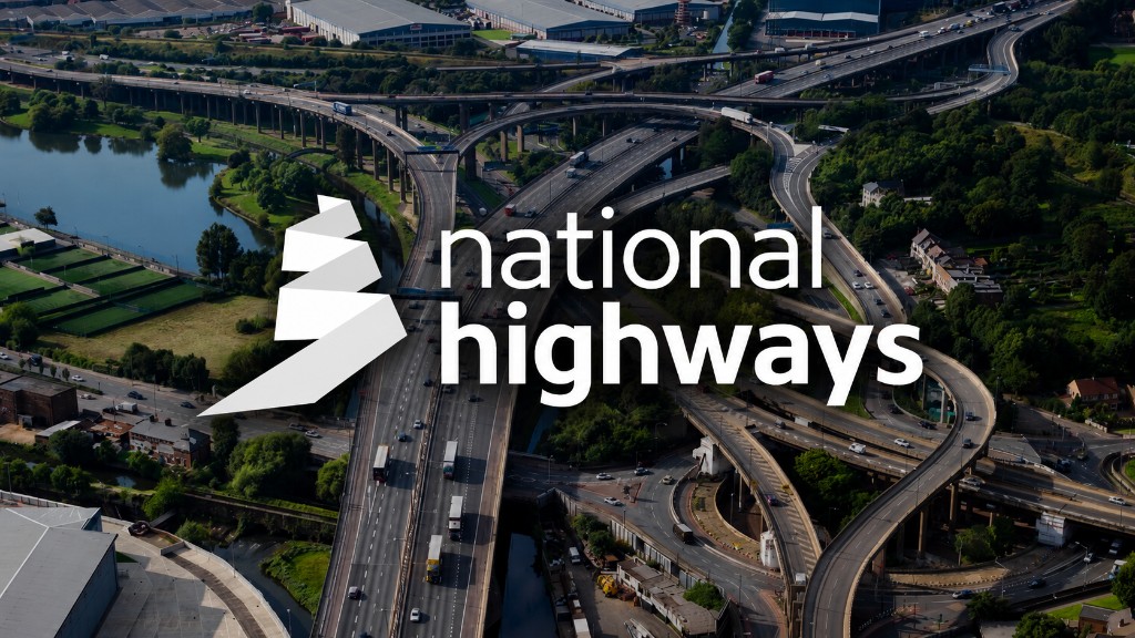
National Highways
Like Network Rail, National Highways have thousands of miles of linear infrastructure that require around-the-clock management. Unlike Network Rail, NH don't have internal teams of drone pilots — Tier One construction partners (Kier, Balfour Beatty and others) manage large highways projects and deploy drones widely across the network.
View case study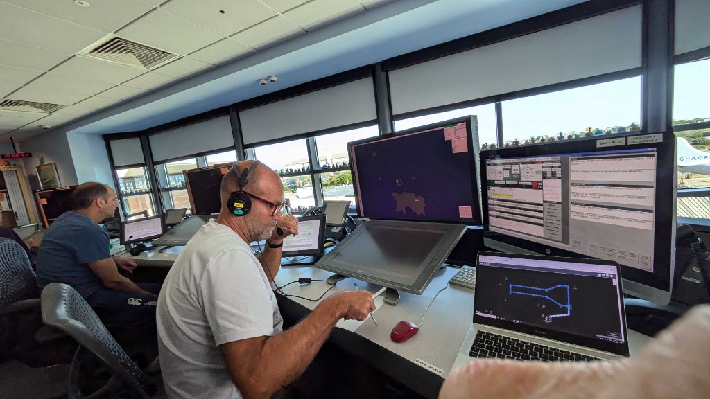
Project ALIAS
Project ALIAS — the AgiLe Integrated Airspace System — was an Innovate UK Future Flight Phase 3 programme demonstrating a scalable airspace ecosystem where drones, advanced air mobility platforms and crewed aircraft operate together through connected operational infrastructure, proven through deployment in the Channel Islands.
View programmeReady to Scale BVLOS Drone Operations?
Whether you manage critical infrastructure airspace or operate advanced drone missions, Dronecloud provides the flight management and UTM foundation needed to scale safely.